 +94 77 461 7752
 +81 80 1351 5271
 +94 77 461 7752
 +81 80 1351 5271
Kawdoco Proudly Presents 3D Point Cloud Application with Device for Architecture and Archaeology Mapping and Geomatics

At Kawdoco, we are constantly innovating and developing cutting-edge solutions to meet the needs of diverse industries. We are excited to introduce our latest breakthrough: a 3D Point Cloud Application paired with specialized devices tailored for architecture, archaeology, and geomatics. This advanced technology provides highly accurate 3D mapping and modeling capabilities, enabling professionals to create precise representations of complex structures and environments. Whether you are an architect, an archaeologist, or a geomatics expert, Kawdoco's 3D point cloud application revolutionizes the way you work with spatial data, offering a new level of detail, efficiency, and accuracy.
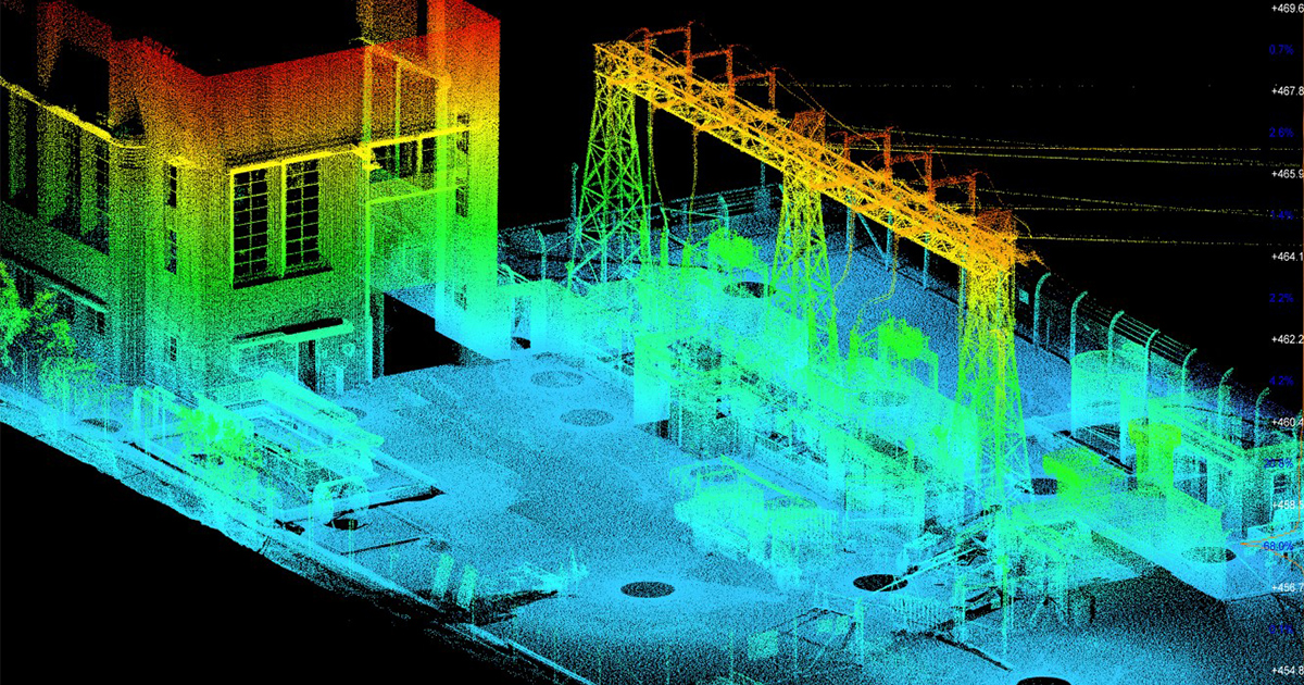
A 3D point cloud is a collection of data points in three-dimensional space, typically acquired through 3D scanning technologies such as LiDAR (Light Detection and Ranging) or photogrammetry. Each point in the cloud represents a specific coordinate in space, creating a detailed "map" of the scanned object or environment. These point clouds can be processed into 3D models, which can then be analyzed, edited, and visualized for a variety of purposes.
Kawdoco's 3D point cloud application offers a comprehensive platform for processing, managing, and visualizing these datasets, enabling users to unlock valuable insights from their scans and surveys.
In architecture, the ability to create accurate and detailed 3D models of existing structures is invaluable. Whether it's for building renovations, historical preservation, or designing new buildings, having a precise model of a structure is essential for informed decision-making. Kawdoco’s 3D Point Cloud Application, coupled with advanced scanning devices, empowers architects to capture intricate details and generate precise 3D models of buildings, facades, interiors, and even entire neighborhoods.
With our application, architects can:
Archaeology often involves working with sites that are difficult to access, fragile, or geographically dispersed. Traditional methods of mapping and documenting archaeological sites can be time-consuming and prone to errors. Kawdoco’s 3D Point Cloud Application offers a more efficient and precise solution by allowing archaeologists to digitally capture and preserve historical sites, artifacts, and excavation findings with unparalleled accuracy.
With this technology, archaeologists can:
Geomatics, or the science of gathering, analyzing, and interpreting spatial data, is essential for a wide range of applications, from urban planning to environmental management. Kawdoco’s 3D point cloud application is a powerful tool for geomatics professionals, enabling them to process large datasets and create detailed spatial models that support better decision-making.
In geomatics, our solution offers:
Kawdoco’s 3D Point Cloud Application offers numerous advantages across architecture, archaeology, and geomatics:
Kawdoco is proud to present its innovative 3D Point Cloud Application and device solutions, designed to transform the way architecture, archaeology, and geomatics professionals capture, process, and analyze spatial data. With cutting-edge technology that combines the power of 3D scanning, point cloud processing, and advanced visualization, our solution is setting a new standard in precision and efficiency. Whether you are designing a new building, preserving an ancient site, or conducting spatial analysis, Kawdoco’s 3D Point Cloud Application provides the tools you need to succeed in an increasingly digital world.
We are excited to continue our journey of innovation, providing solutions that empower professionals to work smarter, faster, and more accurately, while contributing to the advancement of architecture, archaeology, and geomatics.

AI Solution, Robotic and Software Company Sri Lanka
Open: Monday-Friday 9AM-6PM Presnenskaya nab., 10, Naberezhnaya Tower, block B, floor 16.
123112 Moscow Russia
Copyright © 2025 Kawdoco Inc. +94 (77) 461 7752. All rights are reserved.